Thursday, November 25, 2010

Couch Town Pond - Nov 21, 2010

Now that Tim has been laid to rest, it's time to talk paddling again. Doug and I managed to make it out to Couch Town Pond in Webster, NH last Sunday. Couch Town is this really nice little pond that connects to Walker Pond, a slightly larger body of water. There are a few houses and camps on the pond, but it is mostly a wild setting.


1-1/2 miles in by water, the pond meanders through some shallows. A pond abundant with wildlife on most days, this day was quiet. Since everything has flown South for the winter (except for Doug), this is the transition season after the migration and before the snow and ice come in.


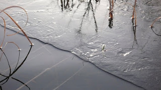
The day was cold. 42 as we put on the water, and 32 as we pulled off. The pond did show its first signs of ice along the edges. On our return paddle out, more ice began to form in sections we had paddled through earlier. Winds were down, the sun was shining and our paddles were frozen. Perfect way to spend a Sunday afternoon.


As we were pulling off the pond, dusk was coming on quickly. As we harnessed the boats to the truck we could see a full moon rising over Colby Hill. To which we quickly tied everything in and made a fast journey up the hill to get some photos of it. It's amazing how fast the moon can change as it rises. We missed the large, orange glow, but still managed to catch the moon over the road.

This days paddle was a therapy paddle. Not that any other days paddle isn't therapy, todays was just more needed than others. Total miles today a measly 3, but the quality of the mileage was high.

Sunday, November 14, 2010

Saco River Trip - Day 3

Ah.... day three. We awake to a heavy frost, smoke on the water, a receding river and a fire already going compliments of Scott's hard work. The view downstream is easterly from our site with the sun (which we haven't seen much of) working hard to make its way through the low lying clouds and mist. Our lines and painters are frozen in place from the nights chill. One of the best things about waking this morning is day light savings where we gain an hour.

A view of the campsite looking downstream. Doug's Mad River Malecite on the right.

We stoke the fire and begin to motivate ourselves around camp. Doug makes the coffee in his almighty coffee pot, a.k.a. the AMC, which has more miles on it than Doug has himself, and Scott rips open a package of marinated steak tips which he quickly throws in his skillet for a hearty steak and eggs breakfast. We eat, we take care of business and begin to break camp about 8:30 and on the water by 9:00.

The markings of some strange creature called Fiddleheads who appear to not understand our ways. They mark many trees in some primitive form with strange writings and graphics called "signs" that we have yet to understand. They seem to not want us paddlers around.

A chilly paddle off this morning the temperature feels to be dropping, not rising. We run into two other paddlers in an Old Town Penobscot camped a mile or two downstream from us in the high grass. They put in Friday also and were headed downstream for Hiram, which is another nights camp and day's worth of paddling. Their motive on the water this time of year was the same as ours. A late season paddle without anyone else on the river, avoiding the summer rush and feeding frenzy of alcohol and ignorance this river is so popular for.

A chilly paddle off the river, Doug paddles just above the Brownfield Bridge where we take out.

Aside from the airplanes we can hear a few miles away at the local municipal airport, it was an unbelievably quite paddle off this morning. Not much wildlife stirring in the woods or water as everything must have already headed south for winter and I think the deer and squirrels went too.

We get to the takeout at Brownfield Bridge about 11am and begin our shuttle. Doug and I get to the truck to find the temperature at 34 degrees. Scott awaits Doug and I, and pulls our gear and boats up from the landing. A much appreciated effort.

Total downstream miles for the day about 8. Total miles for the trip 24. Mission accomplished. To Doug and Scott, thanks for a great trip.


Tuesday, November 9, 2010

Saco River Trip - Day 2

Ah..... Day 2. We wake to a sunny morning under the leantoo and a hunter driving up to our fire. The polite old gent hops out of his Ford to assess who we are and what we're doing at his leantoo. Us being paddlers and him being an Outfitter, we get along just fine. Kind and courteous he dismisses our visit as necessity from the prior days rain and rising water levels. A five minute conversation passes and he's on his way to check the fields for deer. But remember folks, this is private property, however our kind was welcome there. IF anyone reading this post decides to camp at the leantoo, I urge respect with a "leave no trace policy" to not ruin it for the rest of us, but I'd rather you camp somewhere else! Now that's my public service announcement.


Scott and Doug make their way up the Old Course as leave our site Saturday morning.

The morning menu consisted of eggs and Elk sausage stuffed with jalepeno and cheese. Good stuff. We eat then assess the river for what the day may bring. Overnight the river rose about 3 feet under the heavy rains of the day before. We could physically see the Old Course back filling from the volume of water coming down the Saco. Water was being pushed upstream which made our ascent an welcoming surprise, but a return paddle to our almost our demise.


Keyser Pond looking North at Mount Washington

Trusting the helpful hunters guidance on mileage, our ascent was 1-1/2 miles to the pond, which we had other expectations based on other reports and published articles of this section of river. As we enter the pond we can immediately see a snow covered Mount Washington to the North, or left of the pond as we enter. A fairly large pond, the surface was glass with nice panoramic views of surrounding topography. Assuming a launch can be found on the pond, this would be a great put-in and start to a trip.

A view of my bow heavy boat in Keyser Pond just before descending the Old Course.

Time passes and it's time to go, so we begin our 3 mile slog against the current as we descend the river back to the main channel. Constricted areas of the Old Course yielded heavy current, and me with my bow heavy boat did not fair well under those constricted currents. Shortly into our ascent I'm forced to pull aside and reassess my gear situation and exchange weight. Once we return to the covered bridge, the river opened and yielding a milder current.

Back into the main current we catch a surface speed of about 3.5 - 4 miles / hour, so we were hauling. Making our way downstream we pass the Fire Wardens home on the left, then I realize I made a fatal mistake. The mistake being we dropped Doug's car off at Walkers Bridge, not Brownfield as expected. We dock at the bridge and immediately ask a hunter in a kayak how we get our shuttle to Brownfield, and Doug and I begin to haul ass to get this shuttle done. 2:30 Saturday afternoon under cloudy skies, and NOT expecting to drive, we're driving to get my truck to Brownfield. Less than an hour passes and we're back on the water by 3:30 as Scott patiently waitS for our return. Remember this folks, Brownfield is Route 302 in Fryeburg, to Route 5 to Route 160. The shuttle from Swans Falls to Brownfield Bridge is about 12 miles.

Once on the water we begin looking for a place to camp. Below Walker Bridge you'll find many "No Alcohol" Signs posted on trees both river right and left. At about 4:15 we settle for a nice spot just past mile marker 12 on river left that has a high bank and easy canoe access. A fairly level, grassy spot with a pond behind us we make a fire and establish camp.


My tent nestled along the high bank just below mile marker 12, river left

I have dinner detail that night, which was a hearty beef stew which Doug complimented with a bread. We mark a steak in the rivers edge to pay attention to rising or receding water levels, and after about two hours the water was in fact receding. At times we could hear either road traffic or boat traffic from across the river, but couldn't quite establish where it might have been coming from. The site was abundant with wood and an easy spot to establish camp.


Watermark after two hours of receding water

Miles for the day was 1.5 miles upstream on the Old Course to Keyser Pond.
A 3 mile descent down the Old Course to the main channel.
Then about 4 miles downstream to mile marker 12 to camp.
Total Miles = 8 +/-.


Monday, November 8, 2010

Saco River - November 2010

Not a chance the Sherpa will let more time slip by before posting. Yes, I know I haven't finished my Umbagog postings yet, but I gotta strike while the iron is hot. Right? We're talking Saco River here baby! Okay, here we go.....

Trip Details - Fryeburg Maine to Brownfield Maine
Dates - Friday 10/5/10 - Sunday 10/7/10
Crew - Doug D, Scott B and the Sherpa
Put In - Swans Falls
Detour - Up the Old Course
Take Out - Brownfield Bridge
Total Miles - 24 miles

Day 1 - Friday 10/5/10

We left Concord Friday at 7am in a rain to arrive in Fryeburg at 9am to more rain. Dropped gear at Swans Falls then ran shuttle to Walkers Bridge to what we would later find out was the wrong bridge. We stopped at the Jockey Cap (now named after a sport under garment for not packing my $7.00 Tuna Melt) on our way back up Route 302 to pickup the usual Fire Permit and a bagel for Scott. I noticed a pretty good looking Tuna Melt in the display, then got ripped off for One, by not having Fire Permits available as we're required to have them and Two, not packing my $7.00 sandwich that I paid for as I was distracted by the Fire Permit that never showed up. Bagels packed, Sandwich MIA / KIA and $11 bucks later, I'm walking out of the store with two bagels. Doug and I return to the landing to only want a bite of my sandwich, and it aint there. WTF? Regardless, on the water by 10am, and then the real rain came. Had a down pour for most of the day.


8 miles later at 1pm we reached the confluence of the Old Course, river left. At this point, rain was beginning to diminish for our 1-1/2 mile journey upstream to the leantoo we were looking for. The river current was light (if any) as we headed upstream and was in our favor. I poled upstream while Scott lead and Doug followed, arriving at the site around 2pm. Fairly narrow and forested, the Old Course is a pretty paddle.


Shortly into our ascent upstream, the rain had stopped and we were able to unload and hang our gear to dry. An easy bank with plenty of lift off the water unloading was easily manageable. With a fire pit in place (not used recently), Scott did his usual forage for firewood to return with plenty of wood to get a warm fire going in front of the leantoo. Doug had dinner detail for the night with spaghetti and meatballs. PADDLERS NOTE: The AMC River Guide (or former trip reports) post the leantoo as a former AMC parcel, however this is not true. The leantoo has been built and is privately owned by a local land owner, so other paddlers beware. THIS IS PRIVATE PROPERTY. The leantoo is just down stream from a scenic Hemlock Bridge and offers a high bank for pleasant camping with a short 2 minute walk along a well traveled agricultural trail upstream to the bridge.


By 5pm the sun is working its way through the trees. I walk westerly down the trail to the edge of a field to see the Presidential Range due North. Mount Washington an obvious site was clear as the clouds from the days rain move out.

By 8pm no tents are pitched and plans to retreat below the leantoo for the night become an easier decision to make. A welcome decision in fact. Letting the fire dwindle, Doug and I relax by the fire until 9:30 then roll our sleeping bags out below the overhead shelter, which became a very comfortable nights rest. By far one of the best campsites I've rested in.

Total miles for the day. 8 miles to the Old Couse + 1.5 miles up the Old Course = 9.5 miles.


Thursday, November 4, 2010

Trip Report - Umbagog Lake. Day 1

You know, I hate it when it takes me over a month to make an entry to complete a trip report. But as they say, "life's a bitch", right? And sometimes it gets so busy you have a hard time living it, even when you show up for it. Ah, whatever! Enough bantering already. Okay, here it goes.......

Day 1:
The Lake - Umbagog Lake.
Date - September 23rd 2010
The Crew - Doug D; Scott B; Chuck B; Andy S; Gary D; Kenny G (from Florida. Not sure of his last name so I added the G, but it's not the Kenny G you may think it is, because he doesn't paddle).
Trip Details - Magalloway River to Tyler Point, Umbagog Lake
Total Miles - 7

Doug and I pulled into Errol around 9:30am Thursday morning. After doing this trip for the last 5 years we decided to avoid a paddle on the southern end of the lake by putting in on the Magalloway River at the Umbagog National Wildlife Refuge station on Rt 16, just north of Errol. Knowing we wanted to paddle in on the Magalloway and paddle out on the Androscoggin, we decided to hire LL Cote for a shuttle. For a cheap $30.00 you leave them your keys and they'll pickup your ride and drop it off to where you want it to go. For us is was the takeout on the Androscoggin at Steamer Diamond, just above the Dam.

After dropping the keys off we headed South to the Campground to pay our tent fees of $10.00 per night. Scott made the reservations so we paid for our tents as the general policy of the lake applies. We ran into Scott and crew at the public launch next to entrance of the campground, chatted for a minute, grabbed their beer and some gear and ran. They were entering the lake from the southern end, so we decided to help out and carry some of their gear as they were in kayaks.


Day 1. The Magalloway - Overcast and 60 degrees. Entering the Magalloway from the UNWR is an easy put-in with a boat launch. The river itself is shallow and silted with a very mild (if any) current. Easily stroked upstream if needed. It follows Rt. 16 only for a short distance then meanders it's way toward the lake. This section has a few logans on it, but are not mistaken for river channels. Mileage to the lake is 3.5 miles to where we found a very small channel that was cut into the lake. We also could have completed the river about another half mile downstream to where the Magalloway spills into the lake by the Andro. The lake was shallow this year after a very dry summer. Headed south for Tyler Point on the eastern side of the lake, we head past Molls Rock where we run into an older gent who was camped solo for the full moon that week. A nice fella, and a novice poler, he was an unassuming man from Londonderry NH, who happened to be familiar with the legends of Scooter and Hal apparently from a man named Carp. As proud and honored as Doug was for being such a cult status symbol in the paddling world, Doug left four wife beaters behind for the unassuming man from Londonderry to quench the wet palette of a paddler. (Above photo you see Doug dancing a jig on the Magalloway. Happy to be in a boat again).


From Molls Rock we make our way due South East with a 1-1/2 mile lake crossing toward Tyler Point. The winds were down and weather calm, perfect for a crossing. Averaging about 2 miles per hour fully loaded with gear and beer, the crossing took us 45 minutes. To which we could see the other half of our crew in kayaks arriving at the same time as us. Sometimes things just work out, you know?


From here we scratch our boats on the rocky shore to leave a little paint, otherwise known as a paddlers footprint as we unload the boats for a restful nights stay. We setup camp, group gear first, personal gear and tents second, me in Maine, the others in New Hampshire. Maine is more restful, besides it doesn't rain as hard in Maine. It might not be tax free, but hell, I already paid for my tent in tax free NH, so who cares? Photo from my Maine Camp below.


Doug had dinner that night, to which he made a really good ham and potato soup. The boy can actually cook! Chuck was fishing and managed to land a few small bass. We had a full moon with a really nice moon rise over B Brook Cove behind us. All to bed about 8:30 (except for Doug who made his way to his tent for 7pm). A day well done.